
| |
| HOME |
| About Tenaya |
| About Us |
| 2007 |
| 2006 |
| 2005 |
| Katie's View |
| Route Map |
| Photo Gallery |
| Links |
| Contact Us |
![]()
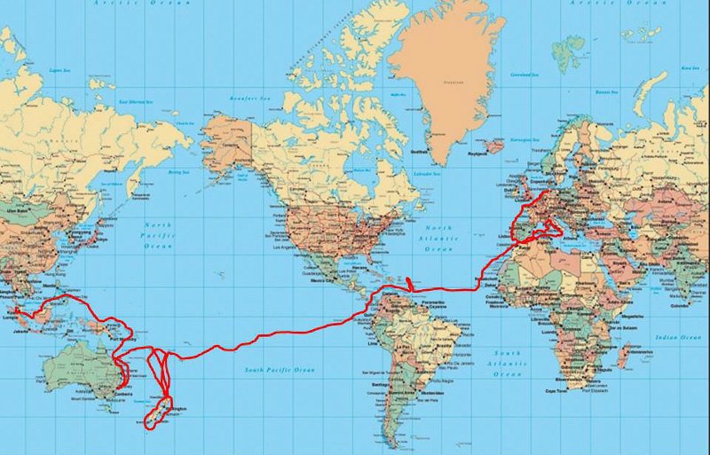
ROUTE MAPS
2014 Palau to Borneo to Thailand
2013 Australia to Papua New Guinea and Beyond
2012 South Pacific to Australia
2012 New Zealand Sailing Circumnavigation
2011 New Zealand Route Map (Driving)
2010 Panama - New Zealand Route Map
2008 European & Atlantic Route Map
2006 Exploring the Netherlands
![]()
NAVIGATION
I create a Passage Plan for each trip, using paper charts and pilot books. Then I enter the waypoints in the chartplotter and double check the route on the electronic chart.
We make log entries every hour when on passage.We have these pages printed and bound into 100 page books and then number the pages.
A a 60 page description of cruising Europe for Americans. From the Crusing Club of America
Electronic charts: Navionics Platinum
Paper Charts:
Once we crossed the Atlantic, we gave up on listing all the charts and books.